
Miami Beach Neighbors by Block
No official Miami Beach household roster exists. Block research instead joins geography with records that cover different groups. The city cadastral service shows parcel shapes and district context. The Miami-Dade Property Appraiser supplies current owner and mailing details for selected folios. Elections can provide a lawful, scoped file of nonexempt voter fields, while directories and permits add historical occupants or project parties. Each source answers a narrow question, and none proves everyone who sleeps at an address.
| Source | What It Shows About a Block | Access |
|---|---|---|
| Miami Beach parcel GIS | Touching parcels, addresses, neighborhoods, ZIP and historic layers | Free city map service |
| Miami-Dade property roll | Owner, mailing and situs address, folio, sales and exemptions | Free county search |
| Miami-Dade voter data | Nonexempt registration fields for defined geography | Formal data request |
| Civic and condo associations | Published board contacts, boundaries and events | Public pages or direct inquiry |
| Directories and permits | Past occupants, businesses, applicants and work by address | Library, digital collection, Civic Access |
An owner mailing address that matches the situs, or physical location, may support owner occupancy. A homestead exemption adds another clue. Neither identifies all Miami Beach neighbors in a unit, and a different mailing address only shows where tax notices go. Corporate or trust ownership is common among condos and second homes. Transfer a map folio to the appraiser before attaching a name because the city GIS layer itself is not the authoritative ownership roll.
Click Around a Miami Beach Parcel
The Miami Beach parcel layer supports the verified adjacency method. Search or geocode the target, zoom until parcels can be selected, click the target, then click every touching or nearby shape. Save each folio. The service does not advertise a one-click resident radius tool, so visual selection is more accurate than claiming a feature that is not documented.
The source view below shows the official parcel layer used to define the immediate block.
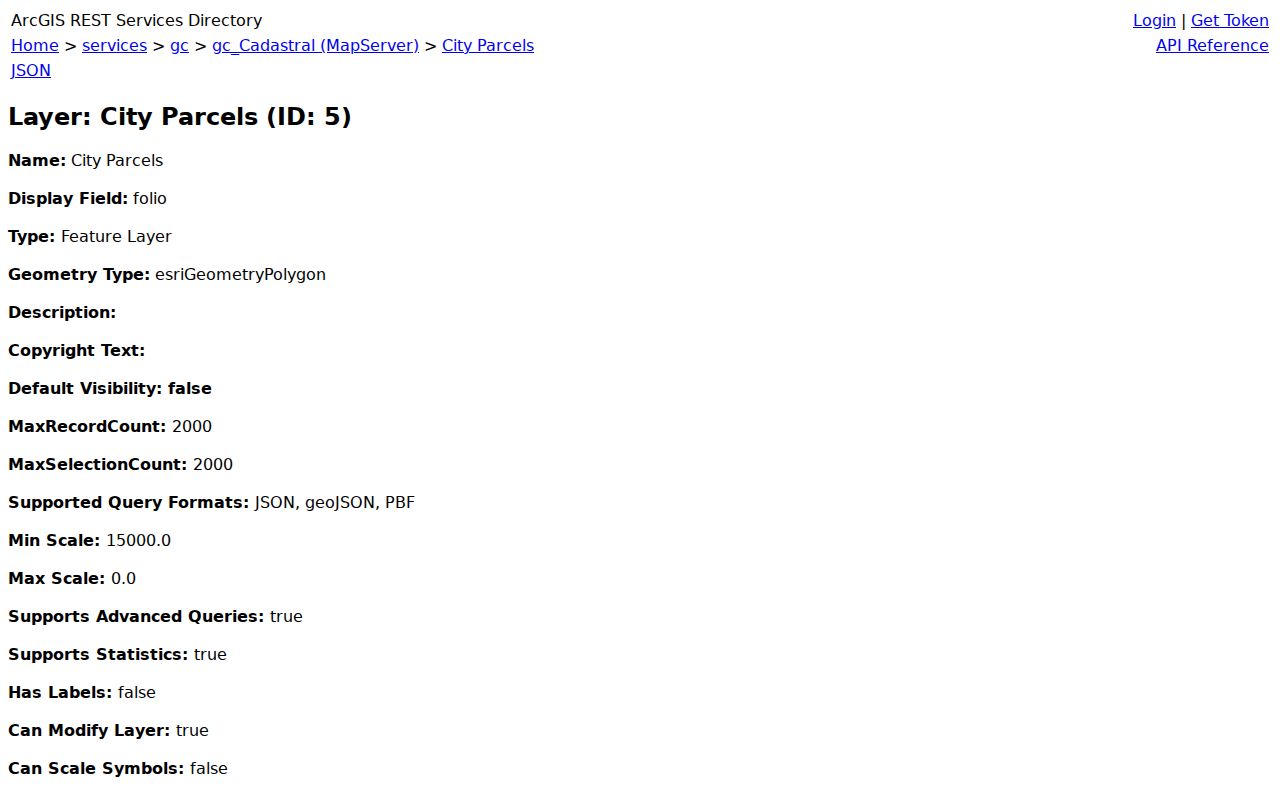
Parcel shapes establish which lots are actually near one another across alleys, waterways, large condo tracts, and irregular island plats.
Miami Beach Neighborhood Map Context
Turn on Address Labels, Situs Points, Street Labels, Neighborhoods, Sub-Neighborhoods, ZIP Boundaries, Historic Sites, and Historic Districts as needed. The city layers place South of Fifth, Flamingo/Lummus, West Avenue, Bayshore, Nautilus, Oceanfront, Normandy Isles, North Shore, and Biscayne Point in their proper local context. Boundaries matter because a postal name, civic identity, ZIP, and municipal line may not match.
South Beach blocks often mix historic structures, hotels, and dense condominiums. Mid Beach includes large oceanfront properties and postwar buildings. North Beach and Normandy Isles use distinct plats and island subdivisions. On Fisher Island, one parcel's access and mailing pattern may reveal little about who is physically nearby. Let parcel geometry lead, then interpret the ownership record in that setting.
Note: City GIS confirms geography, while the county Property Appraiser confirms owner information tied to the folio.
Map Miami Beach Block Owners
Move from one address to nearby recorded owners in a controlled flow: address to city parcel, parcel to folio, folio to county owner record, then back to the map for the next shape. This avoids treating one condo master parcel or street label as the whole block. Keep unit folios separate and compare the owner's mailing address with the situs without turning that clue into a claim about occupancy.
- Locate the address in the Miami Beach cadastral layers and confirm the municipal boundary.
- Click the target and each touching parcel. Record every folio and exact situs address.
- Open each folio in the Property Appraiser search to confirm owner, mailing address, sales, legal description, and exemptions.
- Use deeds or permits only when a dated transaction or address event is relevant. Do not infer residents from an applicant or contractor.
The Miami Beach street directory carries this method along an entire named street. A neighbor search should stay focused on the immediate block and its community context.
Miami Beach Voter Data Requests
Florida voter registration information is generally public, including name, address, date of birth, party, phone, and email, subject to exemptions. The state's personal status lookup is not a browse-by-block directory. For a lawful geographic file, follow the Miami-Dade Elections data-request guidance and specify Miami Beach geography, snapshot date, desired fields, and machine-readable format. Archived voter-related requests can be directed to register@votemiamidade.gov.
Protected voters will not appear with an exposed home address. Florida's Attorney General Address Confidentiality Program provides a substitute mailing address to qualifying victims of domestic violence or stalking. Occupation- and victim-based exemptions under §§119.071 and 741.465-.4651 also protect certain details. A voter file shows registered voters, not every owner, renter, child, seasonal occupant, or person currently at home.
A useful request defines the geography without asking Elections staff to investigate named people. Give a Miami Beach precinct, ZIP, street range, or mapped boundary, then identify the fields and snapshot date needed. Ask whether the agency can produce that geography before assuming it exists as a standard report. If the current file does not answer a historical question, request archived voter-related records by email and state the target election or year. Production fees may apply, and exempt fields should be removed before release. Keep the agency's response with the file so later readers know its date and scope.
Compare a released address with the city parcel layer only after normalizing unit numbers and street forms. A registered voter at a condo address is not proof of ownership, and a property owner is not proof of registration. The two records can corroborate a dated connection to the block, but they describe different populations. Seasonal residence is common in Miami Beach, and second homes or out-of-area tax mailing addresses make that distinction especially important.
Miami Beach Community Contacts
Neighborhood and cultural organizations add a civic layer that government rolls do not. They may publish an officer, board, event calendar, service area, or business-member list. Those are dated public affiliations, not permission to obtain a private member roster. Condo declarations and corporate filings can identify an association and registered agent; private owner communications remain private.
Neighborhood groups
South of Fifth, Flamingo/Lummus, West Avenue, Bayshore, Nautilus, Oceanfront, Normandy Isles, North Shore, and Biscayne Point have local identities best checked against the city neighborhood layer.
Library and archives
MDPLS Special Collections offers directories, photographs, maps, census material, and staff help for reconstructing older blocks.
Cultural institutions
HistoryMiami, Jewish Museum of Florida-FIU, the Wolfsonian-FIU, preservation groups, and university collections may document communities and buildings under their own access policies.
Religious bodies, chambers, and preservation organizations also publish contacts or business directories. Their files should be used only within the access terms set by the institution.
For a condominium, search the recorded declaration to confirm the legal association name, then use Florida corporate filings to identify its current registered agent and filing address. Those filings establish service and corporate roles, not the homes of board members or unit occupants. City business tax receipts and state license records can clarify an on-site business in a mixed-use building. They should not be stretched into resident claims.
Community archives are most useful when the question concerns how a block changed. Miami Beach preservation collections, historic photographs, neighborhood maps, newspapers, and organizational records may connect an older building name with today's parcel. Access differs by institution, so check the catalog and appointment rules before visiting. Religious registers and private organizational files remain subject to the institution's consent. Public board contacts can open a research conversation, but they do not create a right to a member list.
Official Miami Beach Neighbor Evidence
Commercial neighbor tools merge public and licensed data, sometimes long after a person moved. They may combine two people who share a name or attach an old phone to the wrong household. Official sources are narrower, but each fact has a named custodian and date. Verify a map shape with the city, an owner with the appraiser, a deed with the Clerk, and a voter field with Elections.
| Source type | Strength | Limit |
|---|---|---|
| Official parcel and roll | Current folio, owner and mapped land identity | Not a household roster |
| Official voter or permit data | Dated, defined fields from a custodian | Exemptions and limited populations |
| Commercial compilation | May suggest another record to check | Stale, merged, unclear provenance |
Rebuild Historic Miami Beach Blocks
For past neighbors, use a street or criss-cross directory, where entries are arranged by street and house number, then pair the result with the 1935 or 1945 Florida census and open federal schedules through 1950. The MDPLS Genealogy Collection holds city directories, telephone indexes, 27,000 books, and 35,000 microforms, though exact Miami Beach volume years require catalog or librarian confirmation.
Permits and code cases in Miami Beach Civic Access may identify a project party, owner, work site, description, date, or status. They help date a block change but do not prove residence. Historic hotel names and condo conversions require present folios, plats, legal descriptions, and historic district material to bridge old and new address forms.
When an online trail ends, use the documented fallback rather than treating silence as proof. Genealogy librarians offer onsite and e-reference help, and much of the MDPLS material is in-library use only. A focused Florida public-records request can seek existing Miami Beach permits or final code records by address, folio, record type, department, and date span. Ask for electronic delivery and an itemized estimate before extensive work. For an older parcel, carry its legal description to the Miami-Dade Records Library, where public computers support party, CFN, book/page, and legal-description searches. This route preserves a block's identity through replats and renamed buildings.
Protect Miami Beach Neighbors
Public ownership is not consent to contact, watch, or publish personal patterns. Driver data is restricted by federal law. Protected addresses, sealed and juvenile cases, utility information, and private association membership are not gaps to work around. Correct a public-record error with the custodian that created it. Under Florida's record-specific system, a person who qualifies may seek statutory redaction or the Address Confidentiality Program rather than a blanket deletion from all government records.
For safety questions, use the narrow official source that answers them. The FDLE offender and predator search is a statutory statewide registry and carries its own use notice.
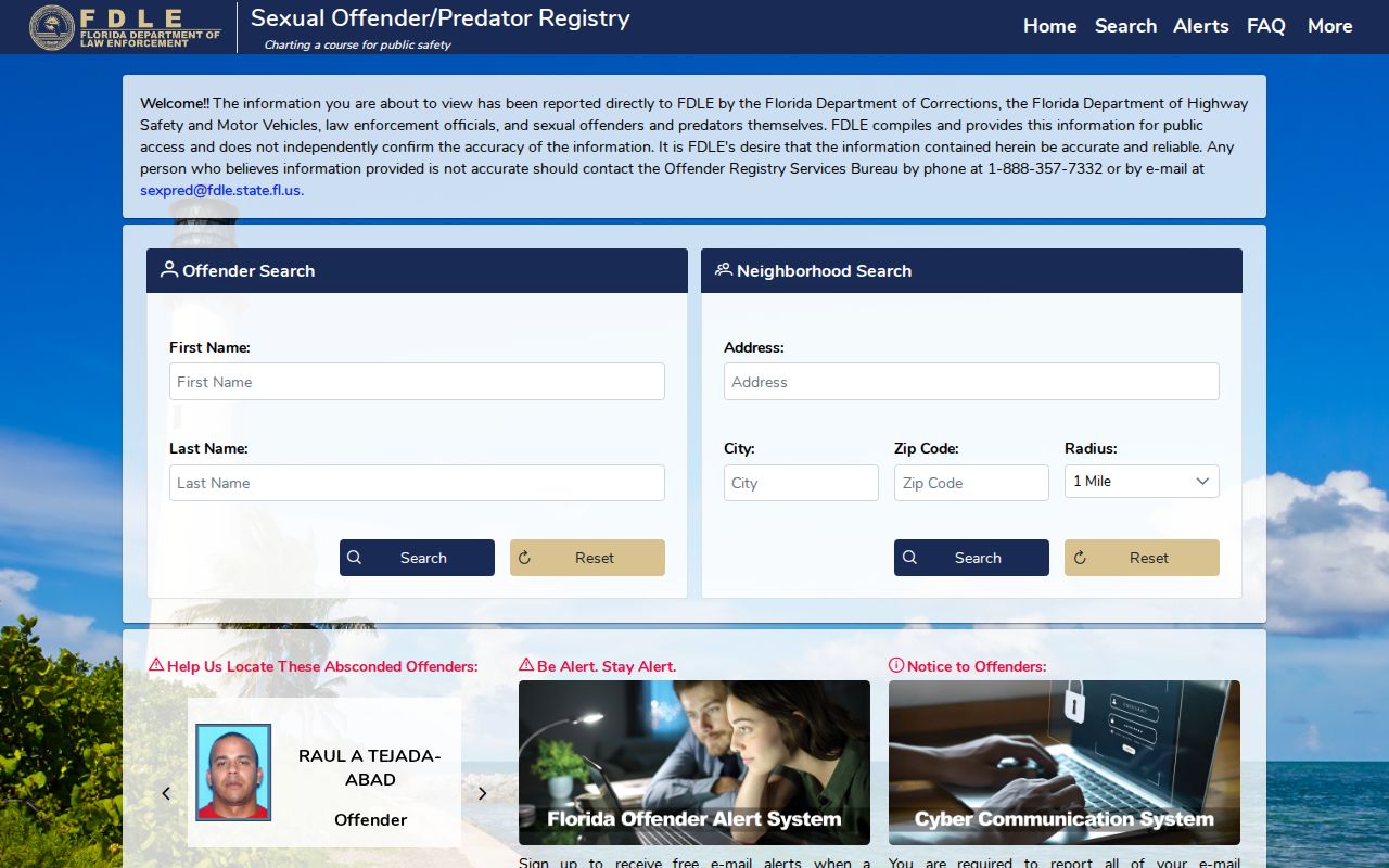
The registry is not a general list of neighbors and must never be used to intimidate anyone. Verify case disposition separately because a charge, custody record, and conviction are different facts.
Lawful use. Use neighbor records for civic curiosity, reconnection, or personal safety. Florida Statute §784.048 prohibits stalking; never watch, threaten, harass, or intimidate anyone.